Innovating Wildfire Management: TREEADS Spanish Pilot in Action
The TREEADS Spanish pilot took place from November 25-28, 2024, showcasing advanced wildfire management and post-fire ecosystem restoration solutions. Held in Pedro Bernardo, Arenas de San Pedro, and Piedralaves, the event demonstrated cutting-edge technologies for wildfire prevention, response, and recovery.
On November 25, the focus was on prevention and preparation. The day began with an overview of the TREEADS project and key technologies like the WebGIS prevention tool and Agroforestry Index and Detail Forest Map for identifying high-risk areas. Preliminary fire forecasting model results were also shared, offering real-time risk assessments. Other tools presented included daily fire forecasting, the ForestFire Simulator, and insurance models.
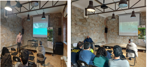
Presentation of TREEADS tools, PP phase2
UAVs with LiDAR cameras showcased precise forest mapping capabilities, followed by discussions on wildfire simulation and economic risk mitigation through insurance models.
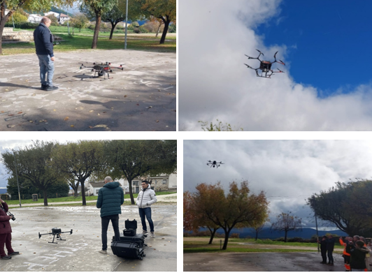
Deployment UAVs with LIDAR camera using CCC – ACCELI / USAL
On November 26, the focus shifted to wildfire detection and response with demonstrations in Arenas de San Pedro. A biomass-controlled burn exercise showcased the Command and Control Center’s real-time resource coordination. UAVs played a key role in fire containment, demonstrating precision in hotspot detection and aerial surveillance, improving response times and firefighter safety.
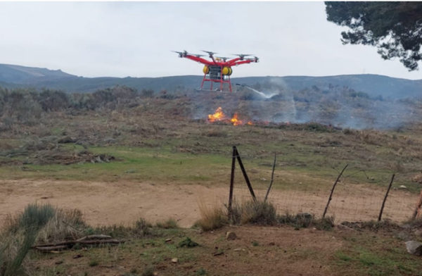
Hot spot extinction with UAVs (EAC Whisper)
The CERBERUS UAV, equipped with a FLIR DUO PRO-R sensor, provided simultaneous RGB and thermal imaging for accurate hotspot detection. Its integration with advanced detection algorithms enabled real-time data processing and transmission, proving its effectiveness in challenging wildfire scenarios.
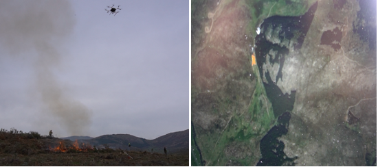
CERBERUS equipped with the FLIR DUO PRO R sensor performing Hot Spot Detection (ACCELI)
On November 27, participants in Piedralaves explored wildfire preparation technologies using AR and VR tools. AR helmets enhanced situational awareness for first responders, while a VR training session provided a risk-free environment for fire management exercises. The day also featured the deployment of the High Altitude Platform (HAP) aerostatic balloon by B2SPACE, designed for extended aerial surveillance. Equipped with EO/IR cameras, it captured high-resolution visuals and thermal data, enabling real-time hotspot detection. Unlike UAVs, the HAP balloon remained airborne for extended periods, bridging the gap between satellite and low-altitude monitoring. Data was transmitted to the Command and Control Center, demonstrating its role in enhancing wildfire coordination and decision-making.
On November 28, the focus shifted to post-fire restoration in Pedro Bernardo. The Burn Area Mapping Tool and Decision Support System (DSS) were presented to aid in restoration planning. The highlight was a UAV-based seeding demonstration using biodegradable Seed Container Capsules (SCCs) filled with native seeds and soil-enhancing microorganisms. This method efficiently reforested a 5000m² area, offering a scalable, cost-effective solution.
Discover the full post here.